Seminars / Lectures
IITM Publication Highlights
Monsoon Mission Coupled Forecast System version 2.0: model description and Indian monsoon simulations
 A new Monsoon Mission Coupled Forecast System version 2 (MMCFSv2) model has been deployed at IITM to replace the currently operational MMCFSv1. MMCFSv2 brings a substantial number of component upgrades over MMCFSv1. Coupled hindcast simulations with April initial conditions from CFSR have been carried out for 25 years (from 1998 to 2022). MMCFSv2 simulates the tropical wind, rainfall, and temperature structure reasonably well. MMCFSv2 captures surface winds well and reduces precipitation biases over land, except over India and North America. The dry bias over these regions remained like in MMCFSv1. MMCFSv2 captures significant features of the Indian monsoon, including the intensity and location of the maximum precipitation centers and the large-scale monsoon circulation. MMCFSv2 improves the phase skill (anomaly correlation coefficient) of the interannual variation of Indian summer monsoon rainfall (ISMR) by 17 % and enhances the amplitude skill (normalized root mean square error) by 20 %. MMCFSv2 shows improved teleconnections of ISMR with the equatorial Indian and Pacific oceans. This 25-year hindcast dataset will serve as the baseline for future sensitivity studies of MMCFSv2.
Jain D., Rao Suryachandra A., Dandi R.A., Pillai P. A., Srivastava Ankur, Pradhan M., Gangadharan K.V., Geoscientific Model Development, 17, January 2024, DOI:10.5194/gmd-17-709-2024, 709-729
Read MoreTrends of lightning flash density over India during different seasons
 Lightning flash rate data measured by the Tropical Rainfall Measuring Mission (TRMM) for the period 1996–2013 over India are analysed to study the spatial and temporal variation of lightning over India during different seasons. This study confirms a systematic increase in lightning flash rate density in India during the last two decades. All seasons have shown more or less positive trends while post-monsoon (October–December) has shown a negative trend. . To further understand the connection between lightning and climate change, a few thermodynamic or microphysical properties are also analysed. This analysis suggests that the high CAPE values together with thermodynamics and cloud microphysical processes are necessary for organized convection and lightning over this region. The increase in lightning activity is found to be due to an increase in CAPE, low-level moisture content and temperature. The increase in temperature and moisture is attributed to the land use land cover (LULC) changes in India. The impact of the above proxies on lightning varies from region to region and season to season. As several regions are undergoing rapid transformation due to human activity, this study provides insights into the need to understand land use related changes to local and regional lightning activity.
Prasanna K., Gopalakrishnan V., Pawar S.D., International Journal of Climatology, Online, March 2024, DOI:10.1002/joc.8400, 1-24
Read MoreThe influence of aerosol hygroscopicity on clouds and precipitation over Western Ghats, India
 To study the role of aerosol hygroscopicity (κ) on the formation of clouds and precipitation over the Western Ghats (WG) in India various numerical model simulations have been used (i.e., particle-by-particle-based small-scale, high-resolution mesoscale model). For the diffusional growth of cloud droplets, the size-dependent hygroscopicity is used in the κ-Köhler equation of direct numerical simulation. The idealized and real simulations using the WRF model with the aerosol-aware Thompson microphysics scheme are conducted by changing κ values. Depending on the type of clouds (shallow or deep), different κ values determine the mass and number of cloud and rain droplets. Low hygroscopicity (organics) simulates more and smaller drops, as well as uplifts below freezing level, resulting in more ice-phase hydrometeors. Organic aerosols have a significant impact on the formation of more snow and graupel hydrometeors. As compared to high κ, low hygroscopicity weakens updrafts at the intermediate level and strengthens them at the upper level in the deep cloud region. The findings indicate that aerosol composition has a significant impact on the activation of cloud condensation nuclei. This study suggests that aerosol hygroscopicity is essential in weather prediction models to integrate aerosol chemical compositions.
Ray A., Bhowmik M., Hazra A., Pandithurai G., Quarterly Journal of the Royal Meteorological Society, Online, February 2024, DOI:10.1002/qj.4654, 1-16
Read MoreUnusual subseasonal variability of Indian summer monsoon rainfall in 2020
 The study investigated the possible mechanisms that are responsible for the July 2020 deficit rainfall. Analysis revealed that the strong low-level moisture divergence caused by the westward-propagating atmospheric Rossby wave, induced by suppressed western North Pacific (WNP) convection, is primarily responsible for the July rainfall deficit. The WNP suppressed convection is linked to anomalous low-level anticyclonic circulation. To understand the importance of the WNP anticyclone on ISM rainfall, a CFSv2 sensitivity experiment is carried out by imposing strong negative sea surface temperature (SST) anomalies over the WNP region to excite the anticyclone. Both the westward extension of the WNP anticyclone and suppressed rainfall over the core monsoon region in July are captured by the model when low-level circulation is imposed. The model sensitivity experiment strongly supports the role of the WNP anticyclone and its westward extension in inducing reduced rainfall in July 2020 over the monsoon trough region.
Darshana P., Chowdary J.S., Parekh A., Gnanaseelan C., Fousiya T.S., Vibhute A., Halder Subrota, Prem Singh, Kakatkar R., Quarterly Journal of the Royal Meteorological Society, Online, February 2024, DOI:10.1002/qj.4675, 1-
Read MoreNew Publications
A mechanistic investigation into the unusual intensification of rainfall over Western India during the 2019 summer monsoon
Ayantika D.C., Sumit K.M., Krishnan R., Vellore R., Guhathakurta P., Atmospheric Research, 299: 107209, April 2024, DOI:10.1016/j.atmosres.2023.107209, 1-13
Observation of a dramatic increase in the positive cloud-to-ground lightning in the Indian summer monsoon season
Ghosh Rakesh, Mudiar D., Pawar S.D., Domkawale M. A., Syed H.A., Hazra A., Gopalakrishnan V., Atmospheric Research, 298: 107119, March 2024, DOI:10.1016/j.atmosres.2023.107119, 1-14
A Statistical Study on Cloud Base Height Behavior and Cloud Types During Southwest Monsoon over a High-Altitude Site in Western Ghats
Leena P.P., Mise D.J., Resmi E.A., Anil Kumar V., Chakravarty Kaustav, Nirmin K.S., Pradeep Kumar P.,Patil R.P., Pandithurai G., Journal of the Indian Society of Remote Sensing, 52, January 2024, DOI:10.1007/s12524-024-01808-2, 203–217
Towards a realistic MISO simulation: impact of rectification
Pradhan M., Rao Suryachandra A., Bhattacharya A., Climate Dynamics, Online, January 2024, DOI:10.1007/s00382-023-07053-6, 1-19
PDF Publisher LinkIITM Events
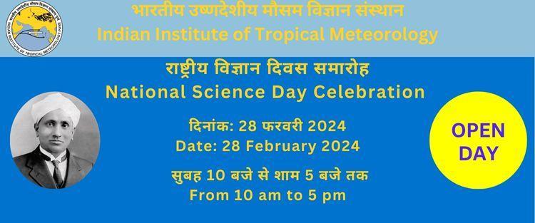
National Science Day 2024
(28 February 2024)
IITM celebrated the National Science Day on 28th February 2024 by observing an open day at its premises. IITM also participated in the two days Science Expo at the Giant Metrewave Radio Telescope (GMRT) observatory at Khodad, Narayangaon from 28-29 February 2024.

